Posts

January

Image
Walking and inspiration Last year I was asked by author Lia Leendertz to illustrate the 2019 edition of her book The Almanac - a seasonal guide . I was both excited and daunted but had no time for either as work started almost at once and I spent May and June working on 50 linocuts. The publisher requested that both Lia and I kept the project under wraps ... no sharing of 'work in progress' on social meadia, which was frustrating as I wanted this blog to be a record of work in my studio as well as walks and the countryside that inspires me. So this year I'll do a monthly post about each of the chapters in The Almanac, with the sketches and linocuts and the countryside that I had in mind as I worked, starting with January ... (click on the photos to enlarge them) The two weeks I had to produce the 12 month-chapter opening illustrations were probably the hottest last year and there was no chance to do lots of new sketching from life, so I r...
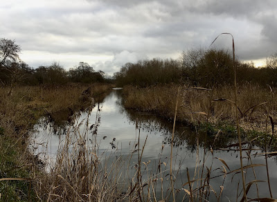
Cavenham Heath and the River Lark

Image
A wander at Cavenham Heath and alongside the River Lark (4 miles) Tuesday 1 January 2019 Weather: mild, 8˚C, north-westerly breeze, mostly cloudy Parked on the track from Tuddenham village green. (please click on the photos to enlarge them) Our first walk in 2019 was a wander at Cavenham Heath and along the River Lark, we were hoping to spot some interesting birds or even an otter (though chance of that at around midday was slim).   Cavenham Heath is accessed via a track from Tuddenham village green, we parked at the point where the woodland ends and the open access heath begins ... the track is very very bumpy! The heathland is open access at this time of year but closed when the Stone Curlews are breeding in the summer. We walked along the main track which is part of the Icknield Way , one of the ancient routes of Britain. Sheep were grazing the heathland, they are part of the management of the area to retain the delicate balance to rare plants and w...

Shotley - a Suffolk estuary walk

Image
The Suffolk coast is sliced by a series of large estuaries, the main towns a largely at narrow crossing point miles from the coast and the main south-north road, the A12, further inland. So a coast road isn't possible and each broad finger of land between the estuaries seems to have its own character. The Shotley peninsula is between the estuaries of the River Orwell and River Stour, a area of undulating farmland, small secret valleys and hidden villages. Today it is quiet and off the beaten track. detail of Philips Suffolk Map 1895 A walk from Shotley Gate, along the Orwell and Stour estuaries via Shotley and Erwarton (6.8 miles) Sunday 30 December 2018 Weather: mild, 9˚C, still and misty Park at Shotley Gate near the Bristol Arms pub. (please click on the photos to enlarge them) From Shotley Gate you can see across the merged Orwell and Stour estuaries to the ferry port of Harwich to the south and the vast cranes of the international container-ship port ...